
Download a pdf copy of all
the latest research that has been carried out on Wheal Victoria at Golitha
Falls:
"Wheal Victoria Copper Mine - History and Remains" by Clive ffitch
(this bookmarked document includes content from all the "History &
Remains", "Further Research", "Underground" and "China Clay
Pipeline" pages)
Photographs taken 2004 to 2019
"All hail! Victoria!"
" All hail! Victoria! yet thy star is set
- thy existance was but brief, and not even royalty could protect
thee from
thy fate. Alas! Victoria is no more! for,
notwithstanding the aid of sovereigns, the pit, which was sunk by
those who
most lauded thee whilst living, has closed upon thee
for ever. No longer shall the pick and gad resound in
cheerfulness - no more the count-house punch be handed round to wish
thee brighter days; nor shall
the yule log blazon on the now
deserted hearth. Thy glory has fled! the lustre which thou shed
around in thy
halcyon days is forever gone, and now, alas! we
mourn the loss of the last sovereign, so much endeared to us.
Reader, be not alarmed, it is simply that 'the bal is knacked'. "
...excerpt from the Mining Journal (11th July 1846).
Sources researched for this page, and for the
Further Research
into Wheal Victoria page, include: "Mines and Miners of
Cornwall" Vol. XII (A.K. Hamilton Jenkin), pub. 1966; plus various
other excerpts from Mining Journals (courtesy of the Cornish Studies
Library, Cornwall Centre) and other quoted sources. Other primary
research included the excellent online mapping resources from the
NLS (National Library of Scotland), and the more recent LIDAR
mapping from Lidarfinder that became available in 2019, plus
specifically, additional evidence taken from on the ground
investigations.
I am also grateful for the use of underground
photos and information in 2011 from Mine Explorer Stuart Dann, and
also “Orphan” of AditNow, plus a walk around Golitha and discussion
with John & Cheryl Manley in 2011.
Found within the English Nature Golitha Falls National Nature Reserve, Wheal Victoria Copper Mine is one of those mines that appears to have escaped much modern scrutiny, and rarely appears in books or mining records and references, where even there it is perhaps left as best forgotten. There is however a wealth of history associated with even this relatively small mining adventure, and there is much industrial archaeology and history still left extant in the landscape of Draynes Wood and down at Golitha Falls that is still able to tell a tale or two. The Liskeard Mining District has no mention of it at all, and it is outside the main Caradon Mining and World Heritage Site areas. Perhaps the record here will at least try to correct some of these omissions.

View of the site of Wheal Victoria Copper Mine in Draynes Wood from
Redgate
The First Excavations (from Cornish Mining Records)
Wheal Victoria was started in 1844, and at the first meeting of the Mine "Adventurers", or investers, held at Webb's Hotel in Liskeard, it was reported that the mine contained eight lodes, of which five were three feet wide. During the first year, an adit (referred to here as the "First Adit") was cut that crossed two small branches of copper, and it was claimed that the copper discovered was an extension of the rich lodes recently found at both the South Caradon and West Caradon Mines on Caradon Hill. In 1846, after 2 years and a cost of £4000, the mine was abandoned with the above announcement.
In the words of A.K. Hamilton Jenkin in "Mines and Miners of Cornwall" (1966), he states:
"In Draynes Wood on the western bank of the River Fowey, an old and now much overgrown shaft shown on the OS Map 27SE marks the site of Wheal Victoria. This hitherto unrecorded mine was started in 1844, the first meeting of the company being held at Webb's Hotel, Liskeard, when the property was reported to contain eight lodes, five of which were three feet wide. During the following year a cross-cut adit intersected two small branches of rich copper ore underlying towards the main lode. This discovery aroused much interest, the copper being claimed as an extension of the rich, and then but recently developed lodes of South and West Caradon Mines, some two miles to the east. In 1846, however, after an expenditure of about £4,000, the mine was abandoned, its demise reported by the Mining Journal with the valedictory remark "All hail! Victoria! Yet thy star is set!" "
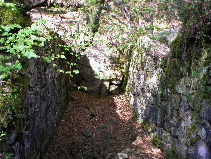
It has been previously thought the the first adit driven in was the apparently larger adit that can be found down by the waterside of the Golitha Falls, but it now seems much clearer that this first adit is in fact the one that can be seen along the track from the entrance to the nature reserve (see map below). It is also not clear at this time that any shaft had been sunk during these first excavations. It has not been found to be stated in any record that there had been, and it is therefore assumed that there was not, and all known shafts were sunk as a part of the second and final excavations. The second (lower) adit by the waterside is associated also with the drainage of the mine, which was only introduced with the sinking of deeper shafts, and the construction of the wheel-pits and waterwheels that powered the flat-rods working the shaft pumps, that took place during the second excavations.
The Second and Final Excavations (from Cornish Mining Records)
In March 1851, a fresh lease was granted, and by the following year, a 30 feet diameter water wheel was operating 150 fathoms of flat-rods, to a shaft sunk to 30 fathoms (180 feet) from the surface. The old First Adit was cleared for 70 fathoms (420 feet), and a new adit (referred to here as the "Second Adit" that can be found down by the waterside) was driven to 100 fathoms (600 feet). A further underground cross-cut was extended towards the Lark Holes copper lode.
Again in the words of A.K. Hamilton Jenkin in "Mines and Miners of Cornwall" (1966), he states:
"The "setting" as it proved, was not of long duration, and in March 1851 a fresh lease was granted. By the following year a 30ft diameter water-wheel, 7.5ft breast, was operating 150 fathoms of flat-rods to a shaft sunk to 30 fathoms from surface, whilst the old adit had been cleared for 70 fathoms, and a new adit had been driven 100 fathoms. A cross-cut was also extended at this time in the direction of the Lark Holes copper lode. In September 1853 the Victoria Engine Shaft was stated to be down to 57 fathoms (40 below adit), "a depth quite sufficient for proving the productive, or unproductive character of the different lodes". A considerable amount of cross-cutting was subsequently carried out but apparently with no success, and by 1855 the mine had again stopped. The massive walls of its two wheel-pits may still be seen in a fine woodland setting adjacent to the cascades known as Golitha falls. Their purpose, however, is difficult to explain since they do not appear to have been employed for stamping, whilst if used for operating pumps they seem unnecessarily far removed from the only shaft which is now visible."
A report in the London Daily News of 25 December 1851 states:
"At Victoria mine, in the cross-cut adit, a lode has been cut, which is supposed to be the Larkholes lode, it is about 25 or 30 fathoms south of shaft, and is composed of gossan and spar, presenting the usual appearance of lodes of the district. At the point of intersection by the cross course, the wheal is progressing favourably".
In the Mining Journal of 5 June 1852, it is recorded that:
"During the past week the shaftsmen have sunk 3ft 6in making altogether 13 fathoms and 3ft below the adit. The winzemen in the bottom of the deep adit have sunk in all about 5ft. The lode in the bottom of the winze is improved in size, and still continues to produce good stones of ore. Our carpenters and smiths are employed about the capstan and shears, the new balance bob behind the wheel, and other work as usual."
The winze written of here may well relate to the winze evident in the Second Adit (see the Further Research into Wheal Victoria page), and the capstan and shears may relate to lifting gear or a whim that would have operated on the Engine Shaft, required to bring the ore to the surface, and the new balance bob behind the wheel (water-wheel) likely relates to a balance bob required for operating the flat-rod run.
With the Engine Shaft down to 57 fathoms (342 feet), and 40 fathoms (240 feet) below the level of the horizontal adit, the cross-cutting was carried out on cross-coursing viens that ran north-south, which lay across the main lodes which ran east-west. These cross-cuts were carried out to over 7 fathoms (42 feet) in each direction, but with little success. It becomes clear from the following Mining Journal reports that there is perhaps a little conflict of reality and optimism between those reporting. In a report in the Journal of 10 September 1853, progress on the cross-cuts is recorded by J. Barkel (Sept 6) that:
"The south end men have driven 2 fathoms 2ft, making altogether 10 fathoms, and the north end men have driven 3ft, making altogether 6 fathoms. We cannot say anything more about the lode than we reported last, only that we have comenced driving west on it; we hope to give you further particulars respecting it in our next report."
In a further report in the Mining Journal, dated only a week later on the 17 september 1853, it is recorded by J. Barkel (Sept 12) that:
"On reporting on the operations of the last week, I beg to inform you that the south end men have driven 2 fathoms, making altogther 12 fathoms; and the men in the north end have driven 4ft on the lode, which is about 2ft wide, and composed of spar, prian, can, mundic, and spots of copper."
As an addendum to this report in the same Journal, and under J. Barkel's report dated 12 September 1853, it is optimistically stated by Oliver O. Trewren from an earlier written report that was dated the 2 September 1853, that:
"On visiting this mine, I find the engine-shaft has been sunk about 40 fathoms below the adit level, which is 17 fathoms deep, making the entire depth from surface 57 fathoms, a depth quite sufficient for proving the productive or unproductive character of the different lodes. The cross-course on which the shaft has been sunk runs nearly north and south, so that nothing can be done better than to force on the cross-cuts now in progress at the bottom level, which can be done speedily while the ground continues as it now is in each of the ends; they are already extended about 7 fathoms each way from the shaft, and in the north end there is a lode now being laid open, which is composed of gossan, quartz and peach, with spots of copper ore and mundic, but owing to its proximity to the cross-course, it is strongly impregnated with iron, and much cannot be said about its character until some distance has been driven on its course. However, I consider the mine a fair speculation, and in regular course of development. The sett itself is a continuation of the Caradon granite, which together with the cross-course and lodes, is of a character precisely similar to that of the mines of the district, and a few months of spirited perseverance will prove the value of the property."
It is recorded in the Royal Cornwall Gazette on the 5 January 1855, under sales of copper ores, that copper ore sold at Cornwall Ticketings for the quarter ending 31 December 1854, included: "Victoria Mine, 1 lot, 15 tons, £42 7s 6d".
Unfortunately, any renewed optimism was found to be a little too over-optimistic, and the Mine Adventurers' either started to lose their money, or were not convinced and withdrew any further financing. By 1855, the Wheal Victoria copper mine had shut down for the second and final time. Not without acrimony it appears, as it is recorded on the 26 February 1855, that a case was heard in the Vicewardens' Court of Stannaries of Devon and Cornwall; Stannary Court Petitions in Equity (Cornwall), between James Bishop, miner and merchant of East Looe (Plaintiff), and Robert Dunstan, miner and managing agent of Wheal Victoria Mine, of Liskeard (Defendant). The description of the case states "with affidavit of the plaintiff on which to ground motion for an Injunction, and croppped copy of The Times newspaper of saturday, February 24, 1855, No. 21,986, with reference to a notice for the sale of Wheal Victoria Copper Mine". The outcome is unknown.
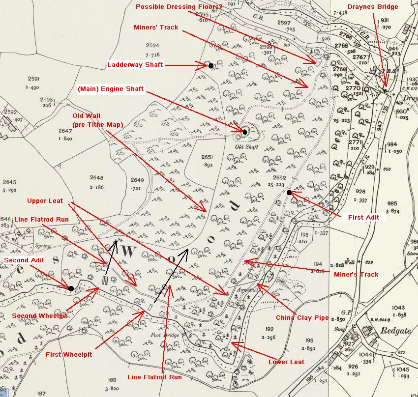
A map of the main extant features of Wheal Victoria, as marked on
the 1892 to 1914 OS Map (post 1908 in this case)
Courtesy of
NLS National Library of Scotland online mapping
This Pipeline is not a part of Wheal Victoria!
This is in fact a "China Clay Pipe". The purpose of it was to
transport china clay (or kaolin) slurry from a pit up on
Bodmin
Moor down to the China Clay Dries at Moorswater for processing.
There are also other items in the woods that are
connected with
this china clay pipeline, and none of them are connected in any way
to the Wheal Victoria Copper Mine.
See the
Parsons Pit China
Clay Pipline page for more details.
The Wheal Victoria Mine Buildings
Near the entrance to the Golitha Falls nature reserve, was this perhaps the site for some of the old copper ore dressing floors, other associated mine buildings, or the count house or hut? This is conjecture only, as the site here has a number of landscape forms that could lead to this conclusion.
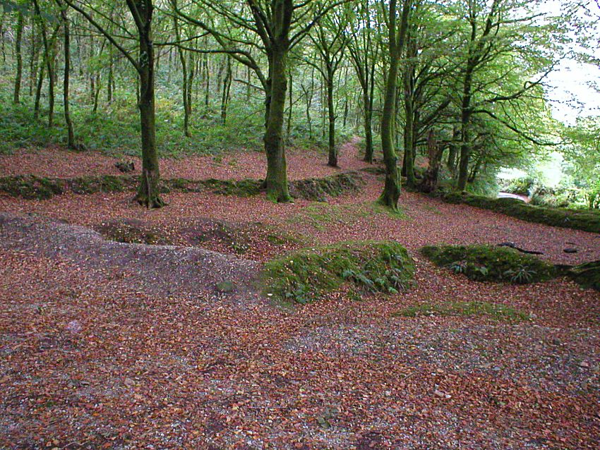
Site of old dressing floors or where the various mine buildings of
Wheal Victoria were sited?
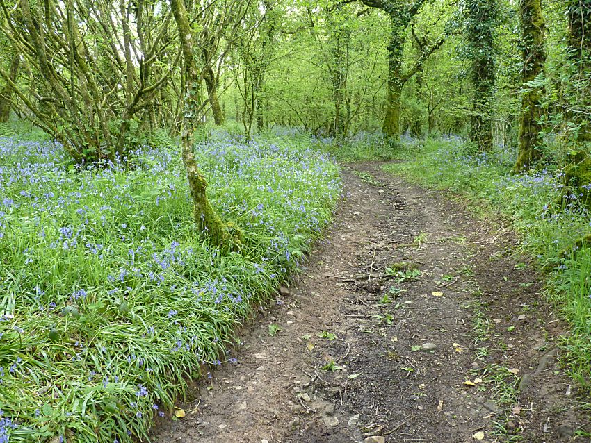
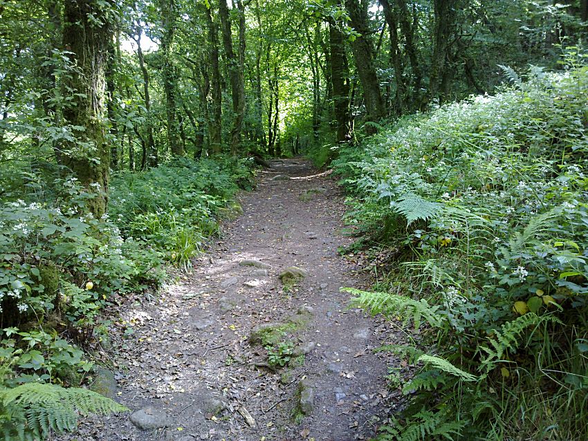
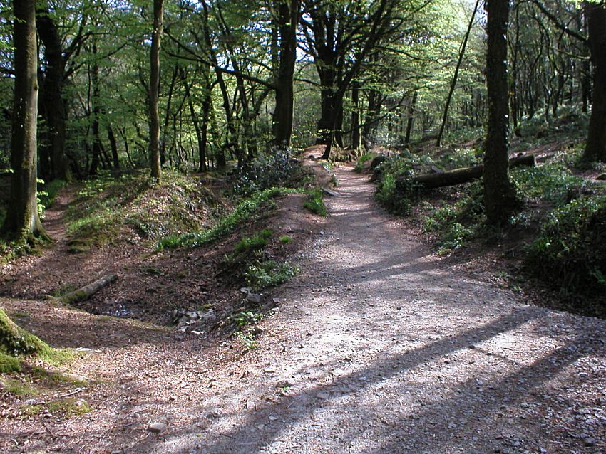
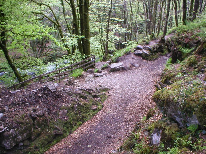
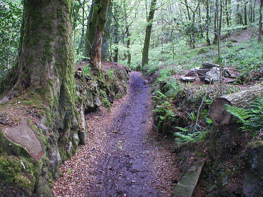
The Miners' Tracks
From the above site, can also be found the well used "Miners' Tracks" that lead to the main shafts and adits. One track (the upper track) leads up to the Engine Shaft that can still be found in the woods above the falls to the left of photo, and a second track (the lower track) leads round to the two wheel-pits by Golitha Falls, and also gave access to the two Adits.
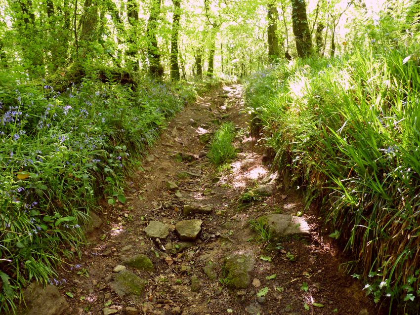
The upper Miners' Track leading up to the Engine Shaft in the
woods
(this is sadly getting more and more rutted and damaged by
water run-off during heavy rain)
Higher up the upper track, leading round past the Engine Shaft (to
the left of the track)
The lower Miners' Track leading out towards the wheel-pits
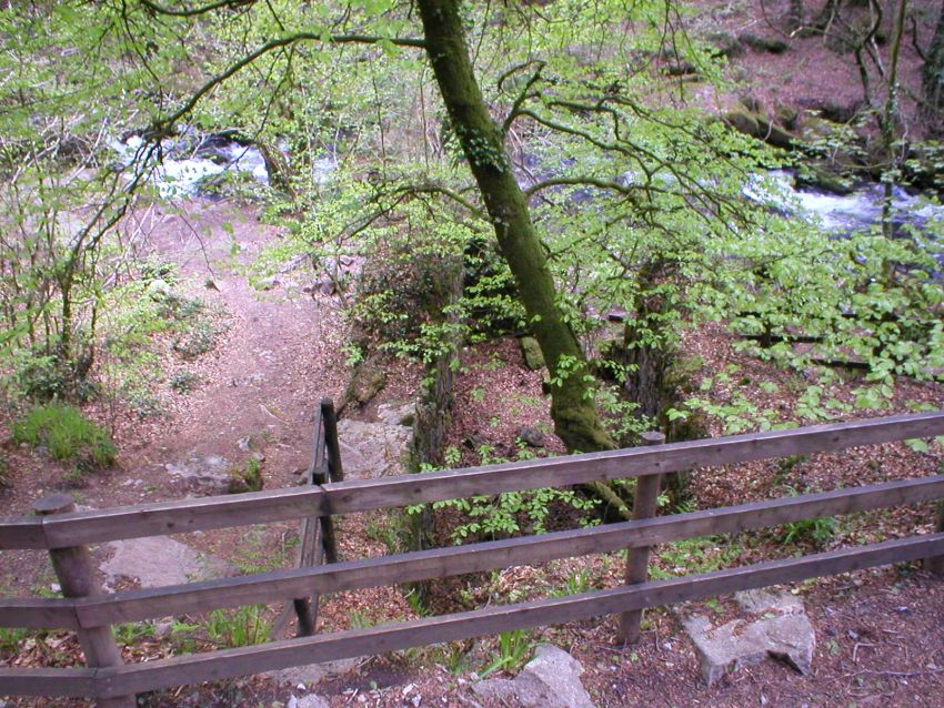
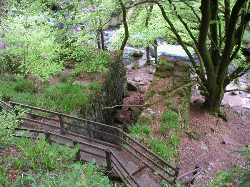
The Wheel-pits, Flat-rod Runs and Leats (1851 onwards)
The massive walls of the two wheel-pits are really all that now remain of the old Wheal Victoria copper mine, or at least they are the most obvious remains that can still be found at Golitha Falls, aside from the two adits and the two shafts that are hidden away in the woods. These more obvious mining features do take a little hunting for, but can be found with a little perseverance.
The wheel-pits housed wheels 30 feet in diameter, which were worked by water fed along a series of leats, or water channels, feeding into the back of the wheels in "undershot" or "under-flow" fashion. The wheels then operated, via "balancing bobs", a series of flat-rods that linked to either the main shaft, or a nearby adit, for pumping out ground water from the mine sump.
The exact purpose of the two wheel-pits has been difficult to explain, as on the face of it, they do not appear to have been employed for copper ore stamping (there are no obvious sign of remains of any ore stamps, nor even any obvious location for them), and if conversely, they were used for pumping, they seem to be unnecessarily far removed from the mine shafts that are visible further up the hill. Or are they? See "Flat-rod Runs" below.
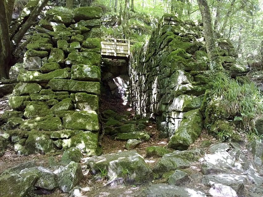
The First Wheel-pit
Following the old Miners' Track along the side of the river and past the upper falls, you will come to the First Wheel-pit. A closer inspection will reveal where the wheel axles would have been supported. The large tree growing out of it in the first photo has fortunately since been removed!
The First Wheel-pit (as it was in 2004 with a large tree still
growing out of the inside wall!)
The First Wheel-pit with the tree now removed, and a lot safer for
preserving the structure
Looking inside the First Wheel-pit; this wheel-pit has not stood up
to the test of time quite as well as the second wheel-pit
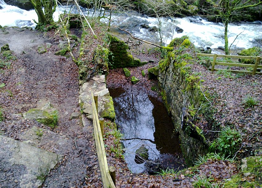
The Second Wheel-pit
The Second Wheel-pit can be found a little further along the side of the falls, and will be seen to be in a slightly improved state of repair to the first, and perhaps a little less encumbered by trees. The reason for this wheel-pit is far less clear, though its purpose must have been significant.
So why two wheel-pits rather than one? Perhaps there were stamps nearby. What purpose did the small structure at the waters edge near the wheel-pits serve (see the photograph below)? Some kind of site office for the water-wheels? However, the best access to remove the ore would have been, and indeed evidence suggests overwhelmingly that it was, from the Engine Shaft up on the hill, and then down the access path to the road/track over Draynes Bridge (or the ford, as the existing bridge was only built in 1876). It is very unlikely that any ore was removed by way of the lower adit (the Second Adit), if indeed this adit had any evidence of a tramway into it, which it doesn't. The idea of bringing out the ore from way down in the woods by the wheel-pits, and from the lower, far less accessible, Second Adit, defies both logic and practicality. This adit provided access, but was primarily for drainage of water from the mine pump, as evidenced by pipework within the adit.
The Second Wheel-pit
Looking into the Second Wheel-pit
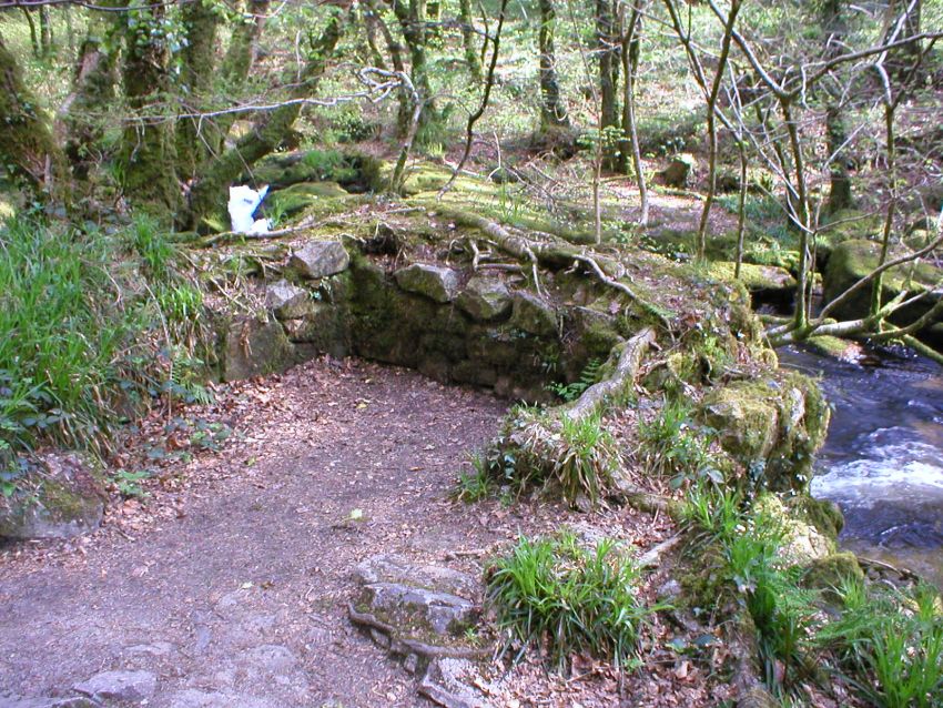
The building structure by the water's edge close to the water-wheels
The Flat-rod Runs
It has been documented that at least one water wheel was used to operate 150 fathoms of flat-rods, and the adits were only 70 fathoms and 100 fathoms deep. This leaves a good 50 to 80 fathoms (300 to 480 feet) between the wheels and the adit or shaft. The lower Second Adit is in fact relatively close to the wheel-pits, but it lies at a very inconvenient angle to enable a flat-rod link to be made to it; indeed the visible flat-rod runs themselves do not on the face of it suggest a link to this adit at all. However, more recent research and LIDAR mapping has now shown that the first wheel-pit was almost certainly linked to the Engine Shaft up on the hill - see the Further Research into Wheal Victoria page for more details and evidence of this.
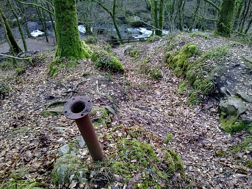
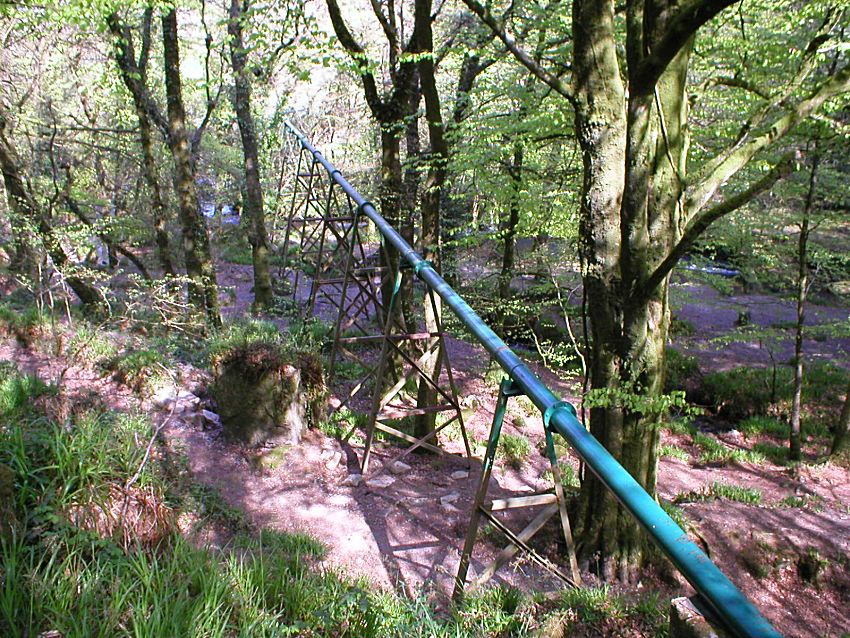
Looking down the Flat-rod Run towards the First Wheel-pit
(Note
that the embedded pipe is nothing to do with the mine, but is a vent
/ survey access pipe for the
China Clay Pipeline,
which was
constructed long after the Wheal Victoria Mine ceased working)
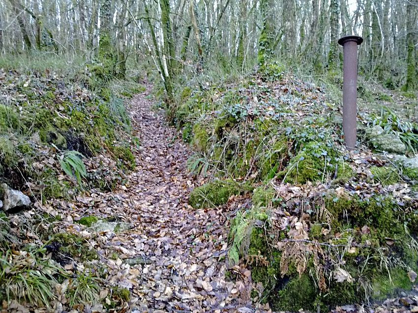
Looking up the Flat-rod Run from the First Wheel Pit (past the China
Clay Vent / Survey Pipe)
From new evidence discovered, it appears that the Second Wheel-pit may also in fact have been used for pumping out the mine, but via a now hidden Third Shaft possibly situated either up, or on, the hill above the Second Wheel-pit. However, the discernable route of this second Flat-rod run is both limited and confused in its length, which leaves the purpose of this second wheel-pit very much in question and unresolved. This conundrum is investigated more on the Further Research into Wheal Victoria page.
The Leats
The various leats and paths at Golitha Falls and the Wheal Victoria Mine have now blended into a small maze of their own. What were originally leats, or water channels for the water wheels and mine drainage, have now become paths, which has confused them with the original miners' tracks and access paths that would have been used to service the mine and perhaps even to remove ore. Some parts of the leats that are not paths are dry, and much of what has been identified as the "lower leat" has remained a water channel, and has been severely scoured on occasion by flooding from the river.
The Upper Leat, not on the left, but the now path on the right,
tracing its course towards supplying the wheel-pits
The Upper Leat as it passes the fist wheel-pit, and crosses the line
of the flat-rod run that would have passed over it
The Upper Leat
The Lower Leat appears to lack real purpose. It feeds back into the river above the wheel-pits, and was not used, it seems, to provide any motive power for the mine. It is possible that is was an "overflow" leat for the upper leat when it was previously connected in some way, to take excess water away from the water-wheels feed, in times of heavy rain and high flow rates entering it from the river.
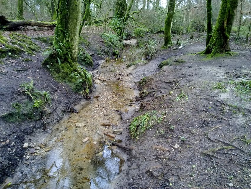
The Lower Leat after being scoured by floods in late 2012
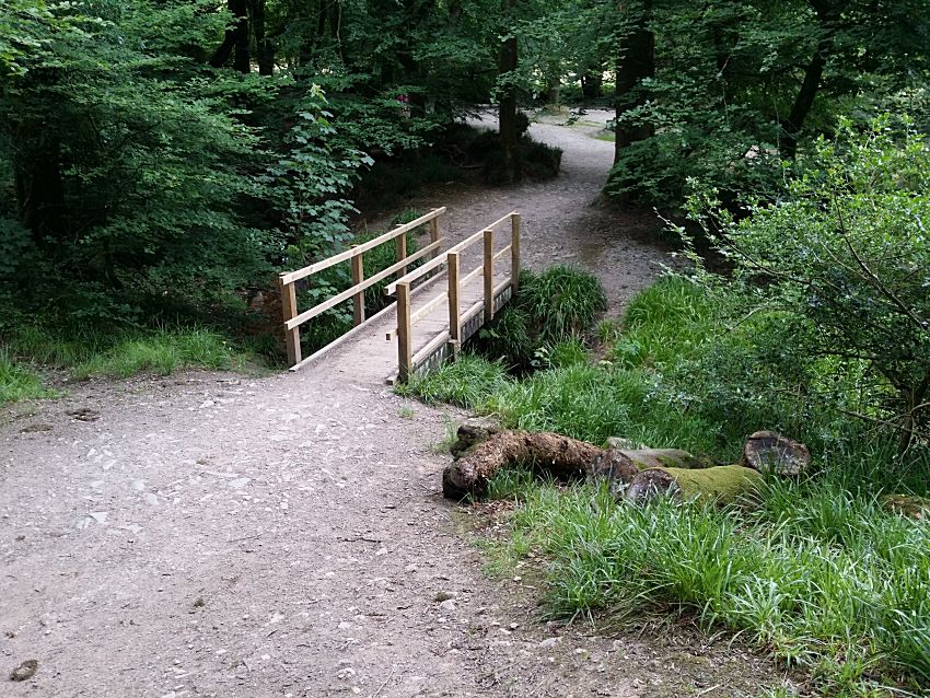
The Lower Leat and a new bridge over it in 2016
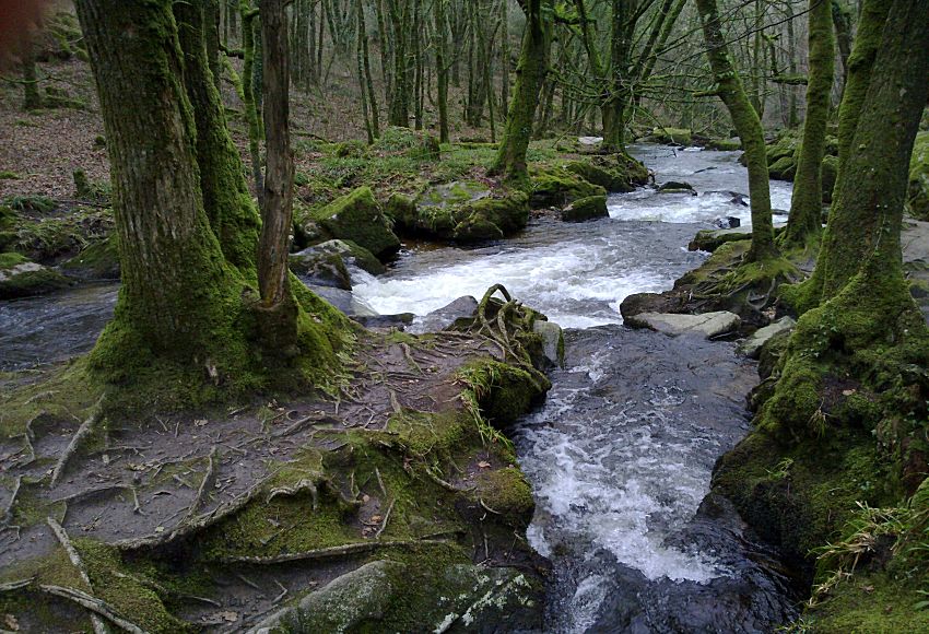
The Lower Leat re-enters the river some way above the Wheel-pits
Looking for the Mine Shafts and Adits? There is much more information on the Further Research into Wheal Victoria page, which links all these remaining features together, and explains how they were all connected.
Sources researched for this page, and for the
Further Research
into Wheal Victoria page, include: "Mines and Miners of
Cornwall" Vol. XII (A.K. Hamilton Jenkin), pub. 1966; plus various
other excerpts from Mining Journals (courtesy of the Cornish Studies
Library, Cornwall Centre) and other quoted sources. Other primary
research included the excellent online mapping resources from the
NLS (National Library of Scotland), and the more recent LIDAR
mapping from Lidarfinder that became available in 2019, plus
specifically, additional evidence taken from on the ground
investigations.
I am also grateful for the use of underground
photos and information in 2011 from Mine Explorer Stuart Dann, and
also “Orphan” of AditNow, plus a walk around Golitha and discussion
with John & Cheryl Manley in 2011.
To see what Wheal Victoria is like
underground, see the
Wheal Victoria
Copper Mine Underground page.
(This page includes some rare
photographs taken by experienced mine explorers - do not try this!)
For more photographs of Golitha Falls
themselves, see the
Golitha Falls
page.
Connect with us, Like us and Follow us on Facebook!
PhotoFile Cornwall supports CoaST and Sustainable Tourism