
(including weblinks to additional online research facilities)
Old maps are fascinating. Really fascinating. They record a mapped out world as it was in days past, and a historical record of places as they once were. The history of human settlements, their size and perceived location at the time. Maps of "Old Cornwall" show villages and hamlets, perhaps with their old spellings, and the routes between them that were important when they were drawn. Not always has the A38 been there! The old primary routes into and across Cornwall are not as they are now, and even some rivers were thought to flow a little differently - such were the mapping and surveying skills that were still evolving at the time.
There are far too many old maps to illustrate here, but as an example, county maps were often a lot more of a work of art than perhaps they are now, even if the accuracy was still evolving and civic divisions a little different...
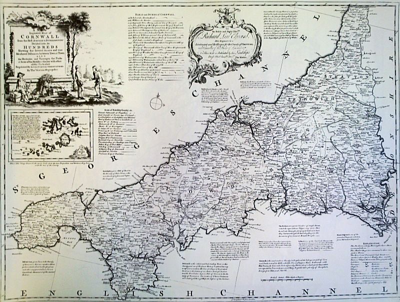
An old map of Cornwall by cartographer Thomas Kitchen, dated from
around 1755
It doesn't even take that long in historical terms for place names to evolve. Even in 1804, just over two hundred years ago, the map below shows Liskeard as "Leskeard"! St Austell only has one "l". So easy to get lost in an old map!
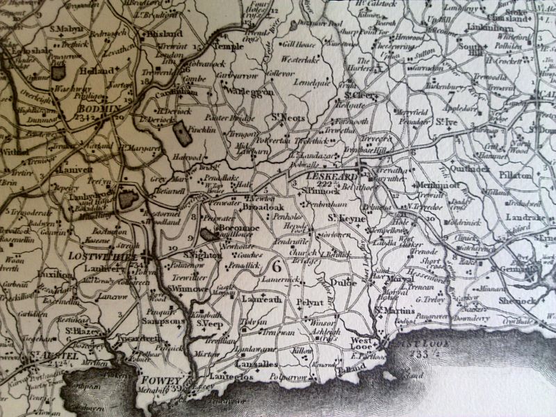
Excerpt of a map from 1804 by cartographer Charles Smith, showing an
area of South East Cornwall
The Joel Gascoyne Map of 1699
The most detailed early map of Cornwall is the very well respected Joel Gascoyne Map of 1699. This is a very rare map - indeed only three copies in various states are known to have survived. Fortunately for map lovers, a superb facsimile edition was produced in 1991, with an introduction book by W.L.D. Ravenhill and O.J.Padel, and produced by the Devon and Cornwall Record Society, but now sadly out of print. However, second hand copies do come up for sale from time to time, and better still, the DCRS have made this excellent map available again through publishers Boydell & Brewer. The facsimile edition is supplied as 13 separate sheets, just as the original was, and these come folded in a hardback case with the introductory book. The map was produced at nearly 1 inch to the mile, and led a revolution in map-making from the late 17th century.
To purchase your own facsimile copy, you can Buy a copy of the Joel Gascoyne Map directly from Boydell & Brewer by following the link.
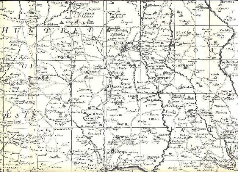
Excerpt from the Joel Gascoyne Map of Cornwall of 1699 - this is the
earliest most detailed map of the county known, and includes a level
of "road" mapping - more correctly noted "tracks" and "ways" thet
were in
use at the time - not seen before.
(excerpt reproduced by kind
permission of the Devon and Cornwall Record Society)
Online Maps
To see some more examples of old maps of Cornwall, there is an excellent page on Rootsweb (hosted by Ancestry.com) that lists and makes available to view a large number of old and antique maps dating from 1564 to 1900...
Rootsweb - Old Maps of Cornwall
For historic Ordnance Survey (OS) maps of Cornwall from over the past 150 years, for search and / or purchase, see...
There is now an excellent site at Old Maps Online that makes access to old Ordnance Survey zoomable mapping, completely free. This is a free access database, containing 400,000+ maps, and has developed out of a love of history and heritage of old maps. The project began as a collaboration between Klokan Technologies GmbH, Switzerland and The Great Britain Historical GIS Project based at the University of Portsmouth. See...
Another relatively recent facility that is absolutely excellent for local research at various old Ordnance Survey map scales, and is also completely free to access and explore, is the National Library of Scotland (NLS) Georeferenced Maps Project. This online zoomable facility provides access to maps all over Britain, and has maps detailed down to the OS 25 inches to the mile series of 1892 - 1914. You can explore two maps side by side - one old map, and one modern map or satellite view, completely synchronised as you zoom in to see how local details have changed. See...
NLS Side-by-Side Georeferenced Map Viewer (Cornwall)
For original or printed old maps of Cornwall by various cartographers that may be for sale, see...
Connect with us, Like us and Follow us on Facebook!
PhotoFile Cornwall supports CoaST and Sustainable Tourism