
Download a pdf copy of all
the latest research that has been carried out on Wheal Victoria at Golitha
Falls:
"Wheal Victoria Copper Mine - History and Remains" by Clive ffitch
(this bookmarked document includes content from all the "History &
Remains", "Further Research", "Underground" and "China Clay
Pipeline" pages)
Photographs taken 2011
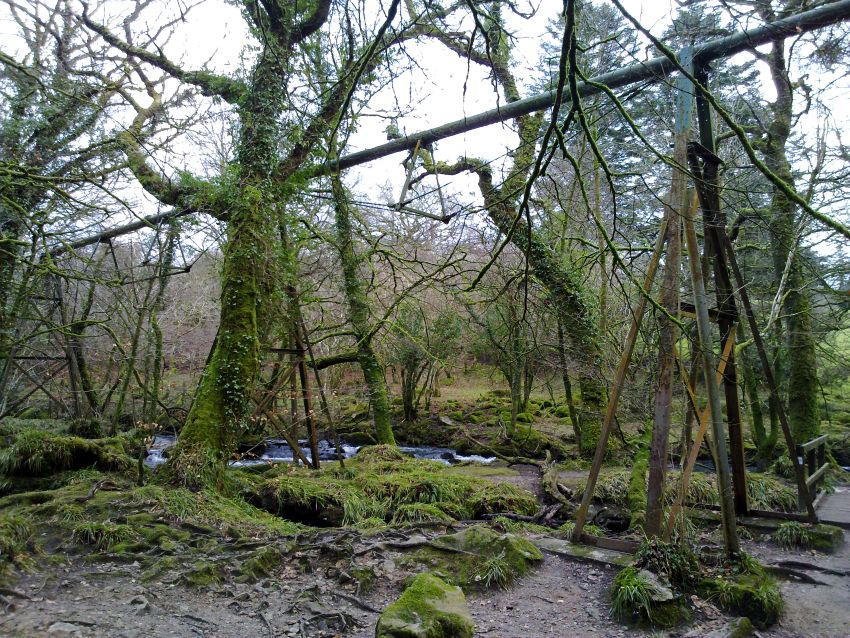
When you start to explore Golitha Falls National Nature Reserve, you will very soon realise that there is a rather strange large green pipe flying right through the middle of it. You might not notice it straightaway, as it is high up, and curiously manages to blend in somewhat with its surroundings. The pipe is a part of a long pipeline, about a foot in diameter, and contrary to a lot of peoples' belief, it does not carry water.
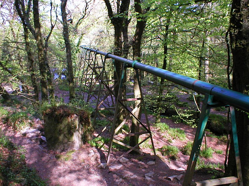
The China Clay Pipeline at Golitha Falls
Looking directly along the now disused China Clay Pipe during the
winter
The pipeline is in fact a China Clay Pipeline, that was built to transport china clay from a China Clay Pit up on Bodmin Moor, down to the China Clay Dries at Moorswater for processing. The pipeline ran initially from Northwood China Clay Pit, and then after a short while was also used by the nearby Parsons Park (sometimes known as Park, or Lords Park) China Clay Pit, and it passes through Draynes, underneath Redgate, and then along a slightly tortuous route, on down to Moorswater near Liskeard. It was used to pump liquid kaolin (or china clay "slurry") from the pit for drying, and after the slurry was processed in the dries, the china clay in powder form was subsequently transported by train to the ports of Fowey and Par. The pipeline was constructed in 1908, and has no connection whatsoever with the Wheal Victoria Copper Mine, the remains of which can also be found down at Golitha Falls.
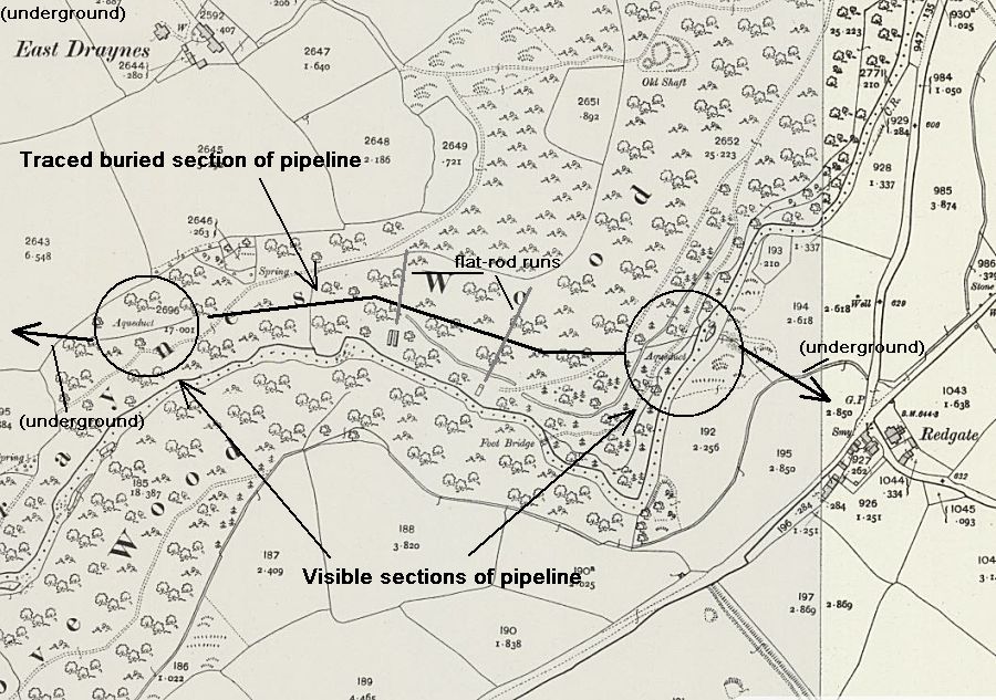
Aproximate route of the China Clay Pipeline between the two exposed
sections, crossing the Wheal Victoria flat-rod runs
Courtesy of
NLS National Library of Scotland online mapping
Documentation about this china clay pipeline is very hard to come by, but one document still available in Cornwall Council archives, is the 1998 Cornwall County Council (as was then) Minerals Local Plan, which refers to Parsons Park Pit. The pit is listed as 290 hectares, and situated SE of Colliford Lake, 3km north of St Neot, within the elevated landscape of Bodmin Moor. The pit supplied china clay for multiple uses, including ceramics, paper filling and coating. The pit itself was closed in 1997. The interesting part of the report however, is that it is the only source that I have yet discovered, that has a map of the route of the pipeline. It only shows the minerals planning and development area, but clearly shows the route, which from rough map measurement appears to be approximately 8.5 miles long. The quality of the map copy on file at the Council is sadly a little poor, but is reproduced here.
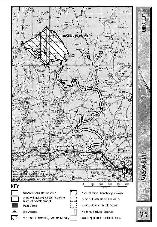
The China Clay Pipeline from the 1998 Cornwall County Council's
Minerals Local Plan, approximately 8.5 miles in length
Courtesy
of
Cornwall Council Archives
The excellent "Bodmin Moor Archaeological Survey; Volume 2: Industrial and Post Medieval Landscapes" has some further details on the history of the two pits and pipeline in question. Northwood Pit had a troubled start, and is shown as disused on the OS Maps of 1882 and 1907. However, there is considerable expansion of the pit evident between the two mappings, indicating that the pit was worked between the two dates. Northwood Pit was re-opened in 1908 and connected by pipeline to new kilns constructed alongside the railway depot at Moorswater, near Liskeard. The Northwood Pit closed again in 1921. Significantly from this information, the China Clay Pipeline running through Golitha Falls was therefore constructed in or around 1908.
The first reference to china clay workings at Parsons Park Pit is to a St Neot works in operation in 1869. The OS Maps of 1882 and 1907 do not show workings on the current site of Parsons Park Pit, and records are a little confused, but it is recorded that the Parsons Park works were re-opened in 1918, and used the same pipeline to Moorswater as the Northwood works. The works at Parsons Park closed during 1942, and re-opened again in 1945. Parsons Park continued to be a major producer of china clay (owners ECCI - English China Clays International), until it finally closed in 1997. The pipeline would then have fallen into disuse, and has now passed into our industrial heritage, never likely to be used again.
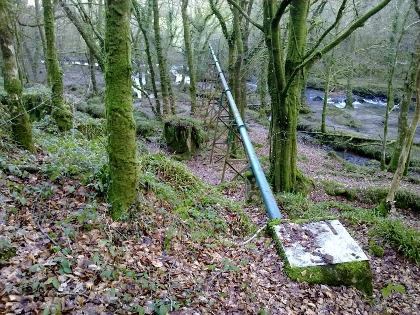
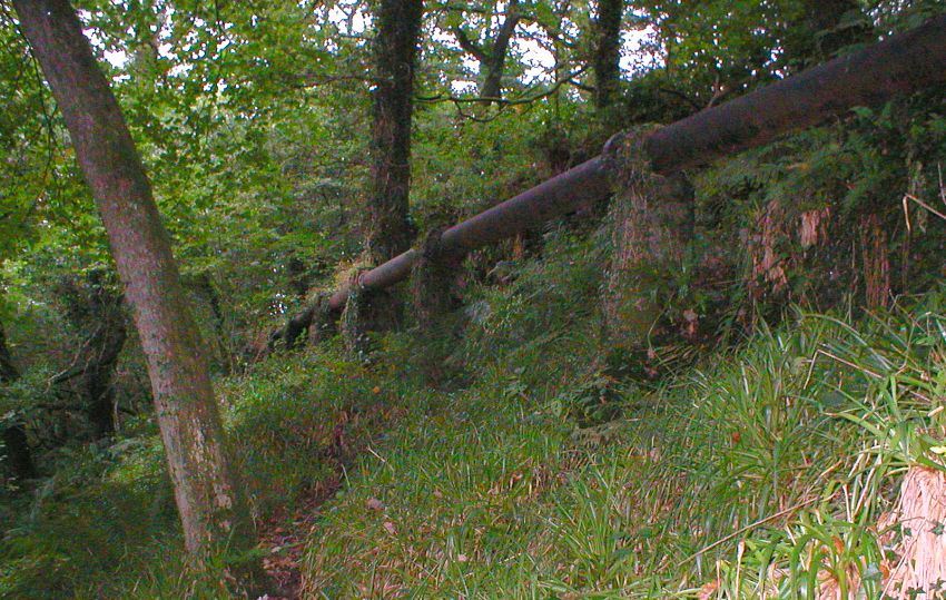
Looking across the river, following the pipe in the direction of
Moorswater
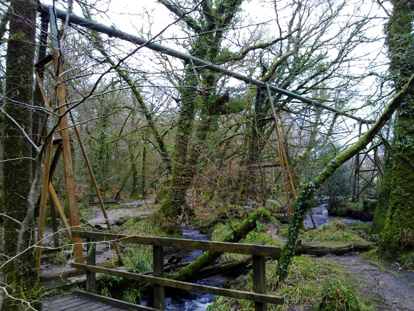
Again seeing how the pipe can almost "blend" into the landscape!
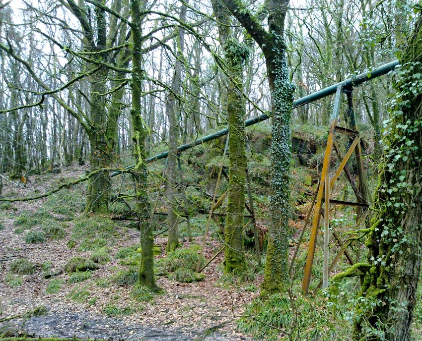
The pipe disappears in a westerly direction towards St Neot, mostly
underground
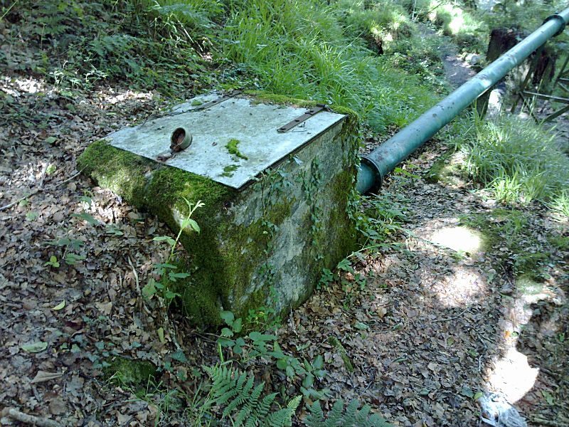
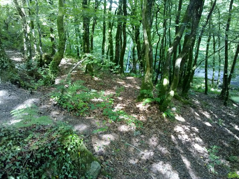
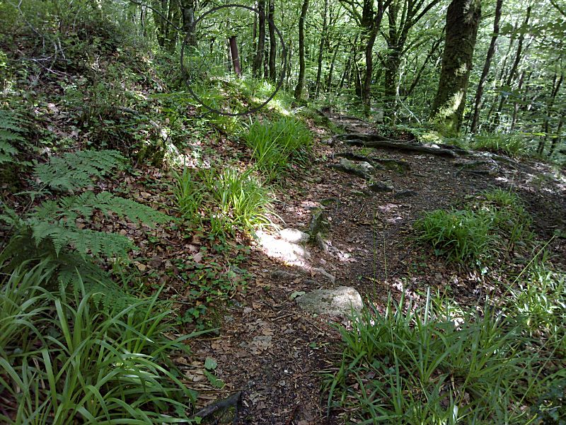
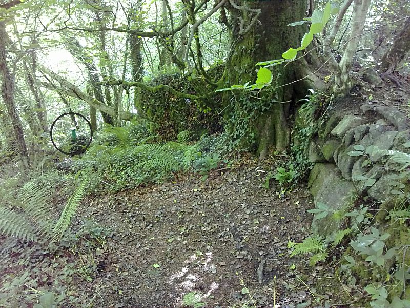
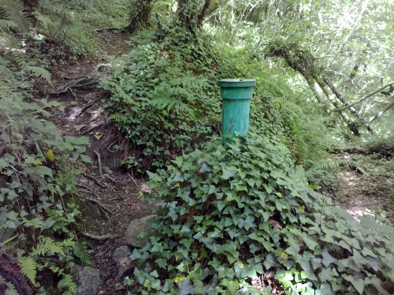
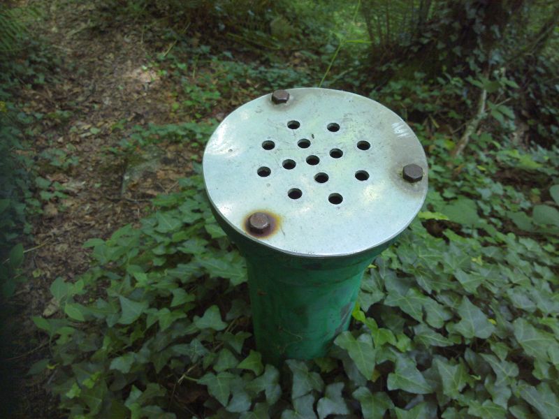
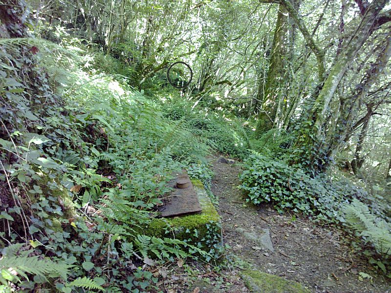
There are various features identifiable in Draynes Wood above
Golitha Falls that are connected with this pipeline, making the
construction and use of it a very significant undertaking. Some of
these features are shown below, before the pipeline temporarily
re-appears from the hillside, before once again disappearing.
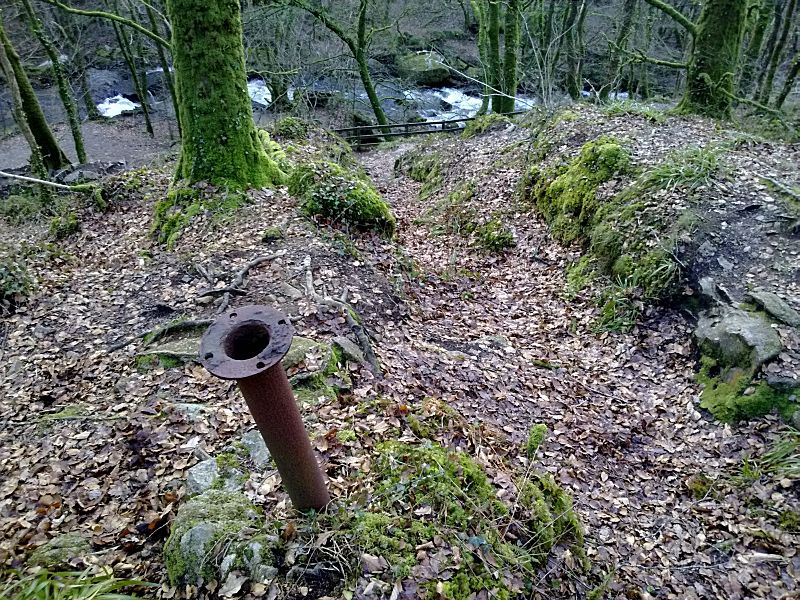
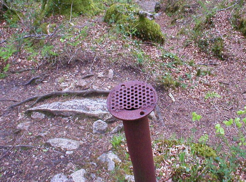
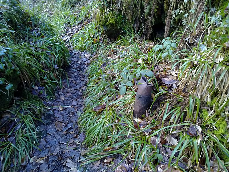
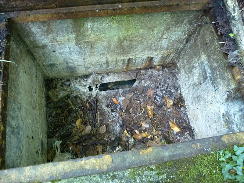
Once underground, the pipeline is then only accessible by a
number of inspection access hatches distributed along its length, as
the major part of the pipeline appears to be completely hidden from
view, as it falls at a gentle gradient all the way from the pit down
to Moorswater.
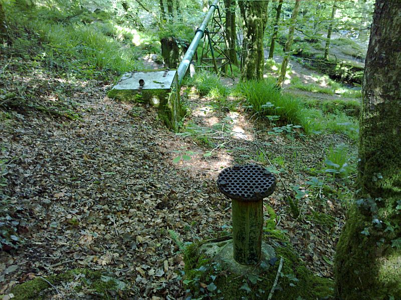
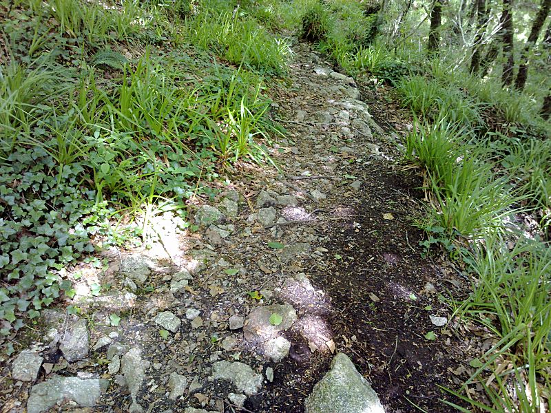
All the associated features evident in Draynes
Wood are very clearly linked by a "pipeline track" on the ground
that has, in the past, presumably been maintained for the purpose of
accessing the various vent or survey pipes, or inspection hatches,
along the pipeline’s length. Some of these features are very clearly
inspection points, with a large rectangular access hatch or cover,
but some appear to be some form of vent or possible
survey/monitoring pipe. Quite how these vents or survey pipes were
used or monitored during the time that the pipeline was in use still
remains a mystery. No documents have as yet been discovered that
describe the operation and maintenance of the pipeline that would
have been needed to keep the slurry flowing along its full length.
Connect with us, Like us and Follow us on Facebook!
PhotoFile Cornwall supports CoaST and Sustainable Tourism