
Photographs taken 2004 to 2011
Ancient Times... River Capture or No River Capture?
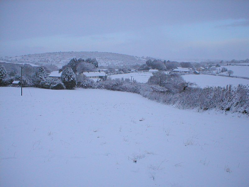
The little hamlet of Redgate nestles on a shoulder of land between the River Fowey valley, right above Golitha Falls on the north side of us, and the East Looe river valleys to the south of us. Part of the East Looe river has its source just down the lane. In geological history the courses of the two rivers were much different for in Redgate, whilst nestling and sheltering between hills to the east and west of us, we are also on the top of hills coming from the south and north of us! For the technically minded, we are now right on the watershed between the two separate river systems, and right on the shoulder of land now referred to as a "wind gap" or "col", which has been postulated as an excellent example of the result of "river capture". This theory has however, also been challenged, as the true reason for differences in valley heights and river cutting is due to other geological uplifting at the ends of earlier ice ages, when the weight of ice over land masses reduced, and land rose, giving rivers effectively greater kinetic energy to cut down, but without the cutting back of their head waters. Interesting debate!
As to the river capture theory, this purports that the parts of the (now) River Fowey to the north of Golitha Falls, were once the headwaters of the East Looe River, now effectively cut off, and now arising to the south of Redgate. When the sea levels fell during earlier times of glaciation, and melt-waters cut deeper into the rock strata, some rivers also cut their headwaters back, and effectively cut off and "captured" the headwaters of another river. The River Fowey did this while forming the gorge that is now Golitha Falls, and then capturing the East Looe River at the "elbow" or right angle turn in the river at Draynes Bridge. This then left the now quite out of place and over-deep valley at the head of the East Looe river; and with the River Fowey cutting deeper at Golitha, Redgate (as the place was named at a much, much, later time) was left over 40 feet or more above both rivers, yet still lying in the remains of the far, far older valley that was once the ancient east Looe River. So there we go - who is right?
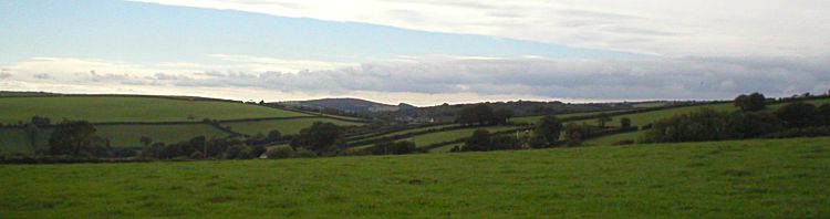
Redgate can just be seen between the valley sides in the centre of
the photo
More Recent History
The more recent history of Redgate hamlet is slowly getting lost in the mists of time, but the hamlet can at least be dated by its appearances on early maps. Maps dated early in the 1800s show that there were certainly buildings in Redgate at that time, and work would have been provided either on the land, or during the later 1800s, at local copper mines such as the Wheal Victoria Copper Mine down at Golitha Falls). There was a working Smithy at Redgate until the 1960s and work may have also included supporting the local mines, though many had their own smithies. There was another known smithy for instance down at Draynes, opposite Golitha Falls and on the site of the current public loos, that could easily have been in support of the mine. Other smithy work would of course been based around the widespread ownership of horses, and on agricultural machinery, then tractors, ploughs, combines and the like. This was much like the way all the old coach makers in the towns moved on from making and repairing horse-drawn coaches, onto repairing and fixing cars.
The present hamlet of Redgate is, and it seems always has been, made up from the two separate farms and settlements, which have given Redgate its name - these being Higher Redgate Farm just up the Minions road, and the closer Lower Redgate Farm nearer to the cross-roads, which is now a house. Both Higher Redgate Farm and Lower Redgate Farm appear on the "New and Accurate Map of Cornwall" (Thomas Martyn, 1748), which is displayed at Lanhydrock House.
Origin of the name "Redgate"
The name of "Redgate" is not an obviously Cornish name, but there have certainly been two very old and established farms here, at Higher Redgate and Lower Redgate, that have been here for several hundreds of years, and which feature on maps made in the 1700s (for instance the 1748 map at Lanhydrock House).
"Red" in Cornish can be taken as meaning "ford", as in Redruth (the ford on the Red river - although "ruth" is also Cornish for "red" just to confuse), but the name in this instance is probably more in keeping with an Anglo Saxon origin, or perhaps a corruption of an original Cornish name. There are however several other "reds" about this part of Cornwall, such as Redpost, Redhill, and Redmoor. Borlase on the other hand, in his “Antiquities” suggests, from Old English that Redgate is “...probably so called from ‘Rhie-gat’ signifying a river’s course”, much as with the name Reigate.
More romantically (or blood curdlingly interesting!) perhaps, is the old local story that once told of Redgate being the site of a fierce and bloody battle that was fought here long ages ago, and that the blood flowed so much and so deep, that it covered the bottom bar of the gate, turning it red! Perhaps that was when King Doniert (or King Durngarth, one of the last Kings of Cornwall), drowned while fighting at Golitha Falls in AD 875 (King Doniert's Stone is just up the road of course), having fought a battle here!!!
Redgate Cross
According to "Stone Crosses in East Cornwall" by Andrew Langdon, Redgate Cross was re-discovered in 1930 after it was being used as a gate post at the entrance to a field at North Trekeive Farm on the road to Siblyback Farm just north of the bridge over the River fowey at Trekeive Steps. The cross was consequently relocated to the crossroads in Redgate, although now somewhat hidden by modern signposts and road-signs.
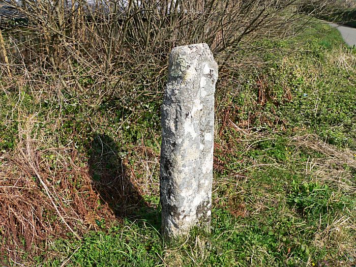
The Redgate Cross, relocated back to the Redgate cross-roads from
its previous use as a farm gate post!
(there is in fact the shape
of a long cross carved in the face of the stone, though difficult to
make out here)
Originally, it would have had smaller horizontal limbs, now missing, which were perhaps broken off at some earlier time to make gate opening easier! There is a carved long cross shape in the front face which is still visible.
Redgate Chapel
There was once a small Methodist chapel at Redgate. The preacher Billy Bray is recorded as having preached here at some time after 1824 (the time he was put on the Local Preachers' Plan). The chapel at Redgate is also recorded in Methodist records as being the first chapel in St Cleer parish, and there is a date stone in evidence that was ceremoniously moved to the newer chapel site at Hockings House in 1939, though the Hockings House chapel itself took over from the Redgate chapel much earlier in 1846. This was the original date stone of the first chapel at Redgate, which is dated 1812 (see the photo below), which according to "Exploring the River Fowey" by John Neale, had originally been on a property owned by a certain Mrs Warren, who was living in the US at the time.
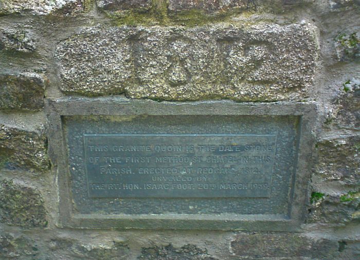
The date stone from the original chapel that was sited at Redgate
and commemorative plaque
The inscription reads:
"This granite quoin is the date stone of the first Methodist
Chapel in this parish. Erected at Redgate in 1812.
Unveiled by
the Rt. Hon. Isaac Foot 20th March 1939."
The exact location of the chapel in Redgate is still trying to be confirmed, given the limited information so far available. There appears no direct evidence of the old Redgate chapel on the old Tithe Maps, though on further research of the Tithe Apportionments, it is apparent one small uncultivated triangle of land may hold a clue. The Tithe Map of St Cleer Parish was surveyed in 1843 and certified in 1846, which is the year the Methodists moved the chapel from Redgate to Hockings House. This may mean the chapel had ceased to exist around this time, or was then being used for other purposes. On the other hand a small building could be listed as anything, occupied or not, and the plot number 1795 shown below is listed as "Cottages and gardens"; occupied by Francis Bone; land owned by Edward Morshead.
This is by no means conclusive, but this odd triangle of land would have been a prime site, and the name of Francis Bone as occupier is also associated with Redgate Smithy (on the corner; plot 1794 on the Tithe Map). Does this mean that he lived at Redgate Smithy at that time but also occupied that land as gardens as well? The square on the map has since been rounded off, and there is some extant built or rebuilt old walling and cornish hedging, but there is a distinctive kink in the road where the map indicates some kind of square building or construction appears to have existed by the roadside. Is this indeed the site of the original Redgate Chapel, or is this just another red(gate) herring?
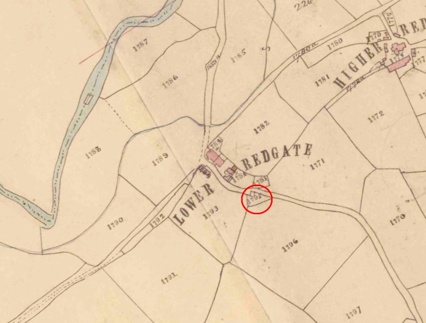
Possible site of the original Redgate Chapel
Looking down the lane towards the triangle, with the remains of the
road indent on the right
(the cornish hedging bank now bends
round where the square on the map indicates the possibility of a
small building)
The building down at Trelaske, which is thought also to be an old chapel (see photo further down), should not be confused with the Redgate chapel which was sited up the lane in Redgate. Numerous buildings were used as chapels at this time, and many were built on small plots of land donated by local farmers and landowners.
John Rowe ~ Historian and Writer
Redgate has its own claim to fame in being the birthplace, and home in his early years, of the well-known Cornish Historian and Writer William John Rowe, who died in 2004.
The following excerpt is from The Independant newspaper, dated 11th June 2004 (see link above)...
"William John Rowe was born 31 October 1915 and brought up on an agricultural smallholding on the edge of Bodmin Moor [Redgate, Cornwall]. Educated initially at Trekieve Steps and Liskeard County School, he won a scholarship in 1935 to read Modern History at Brasenose College, Oxford."
"In 1953 the book Cornwall in the Age of the Industrial Revolution established John Rowe as a key member of a small group of distinguished scholars - the others being A.L. Rowse and Mary Coate - whose work in the middle decades of the 20th century led to a series of impressive publications covering Cornwall from the end of the medieval period to the Victorian era. As Rowse pointed out in a foreword, the work of these three scholars covered the "significant moments" when Cornwall had "impinged on English history".
"Rowe had always taken a keen interest in the cultural life of Cornwall and in 1950 this was recognised by his installation as a bard of the Cornish Gorseth. Retirement enabled him to play an even greater role in Cornish affairs, as President of the Federation of Old Cornwall Societies, president of the Cornwall branch of the Historical Association, trustee of the Cornwall Heritage Trust and council member of the Royal Institution of Cornwall."
The full article about John Rowe can be found on the Independent Obituaries website.
The Lanes around Redgate
Below the hamlet of Redgate on the northern side, literally just down the lane that then runs on up the Fowey valley towards Bolventor and Jamaica Inn, and crossing over Draynes Bridge, you will find the beautiful Golitha Falls.
Opposite the Bolventor and Golitha Falls turn at the Redgate cross-roads, the lane leads down to a turning to Treworrick with fine views over farmland and down the upper reaches of the East Looe river valley, before the lane passes through Treworrick Farm and on to the village of St.Cleer with further views back towards Redgate. In St Cleer there are two pubs, an excellent Farm Shop, and a fine church.

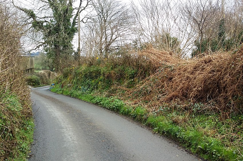
Looking down the lane from Redgate towards the Treworrick turn,
St.Cleer and Lampretten.
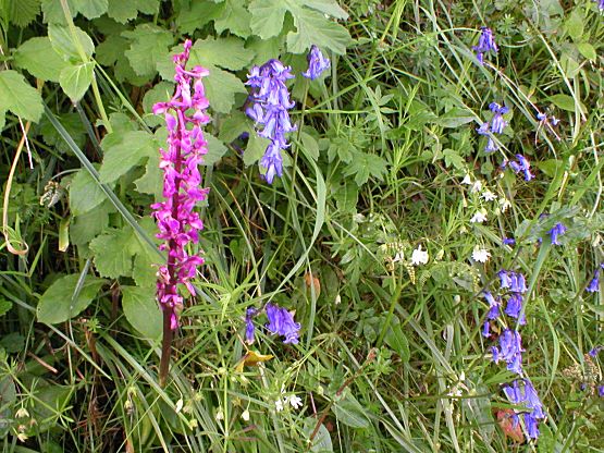
Spring flowers in the lane-side hedges, and wild orchid
If you go straight on past the Treworrick turn, you will find yourself at the bottom of the valley, past Lampretten by the East Looe stream, and all points south down towards High Wood.
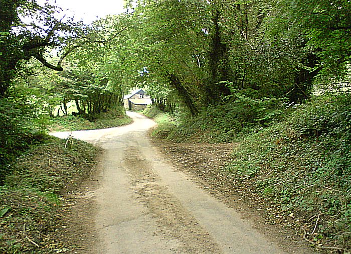
"The Cross-roads" down the lane at Trelaske, looking back towards
Redgate, and an old barn, that again is
an old chapel (but this
chapel is NOT the old Redgate Chapel that was sited up at Redgate
itself!)
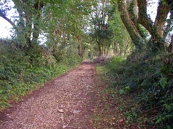
A very pleasant old green lane, along one of the pretty walking
routes to St.Cleer,
that runs up to the right from The Crossroads
in the previous photograph
Farming around Redgate
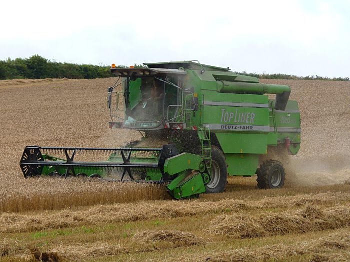
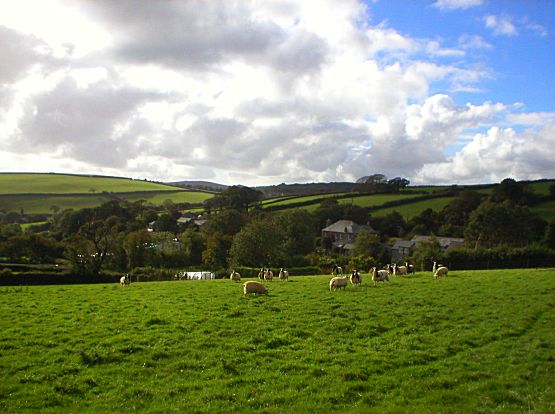
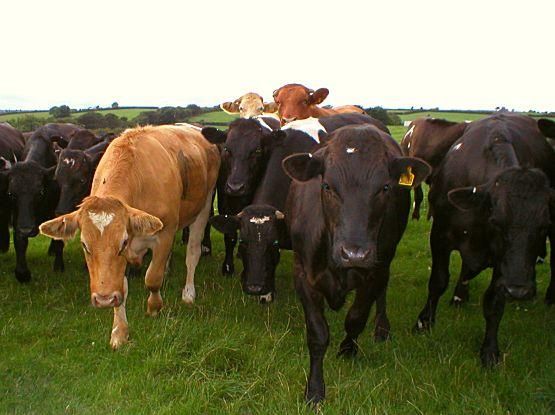
Redgate is set in a very rural location on the southern edge of Bodmin Moor. It is therefore surrounded by farmland which is very important to the local community. Most farming is livestock based, both sheep and cattle, but some arable farming is also carried out. Cattle are farmed for both dairy and beef. The arable fields have been used for grain crops and also potatoes and on occasion turnips.
Connect with us, Like us and Follow us on Facebook!
PhotoFile Cornwall supports CoaST and Sustainable Tourism