
Photographs taken 2004 to 2009
(see the following page for the Caradon to Kilmar section of the line)
The Liskeard & Caradon Railway (L&CR) originally linked up at Moorswater (below Liskeard) with the Liskeard & Looe Union Canal, and then later with the Liskeard & Looe Railway (L&LR). The line was constructed for the shipping of granite and copper ore from the old copper mines and granite quarries on the heights of Bodmin Moor (at over 1150 feet above sea level) to Moorswater, to meet the canal and L&LR for onward transportation to the sea-port of Looe. The L&LR line from Liskeard is still in operation as the very scenic Looe Valley Line.
The Liskeard and Caradon Railway had a convoluted route in its attempt to scale the comparative heights of Bodmin Moor, and this can be shown from the map copies (south section shown here) that are on display in the Minions Heritage Centre, now an information centre for the Cornish Mining World Heritage Site. The line opened originally in 1844, and finally closed as an operational railway in 1917.
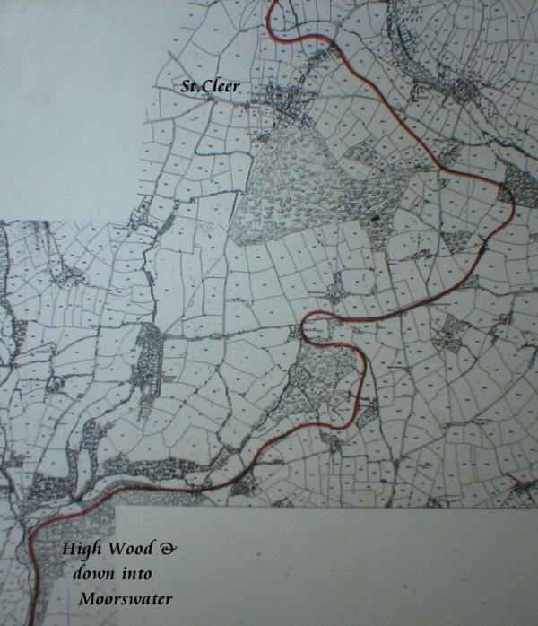
The southern section of the Liskeard & Caradon Railway
(photo
taken from map on display at Minions Heritage Centre)
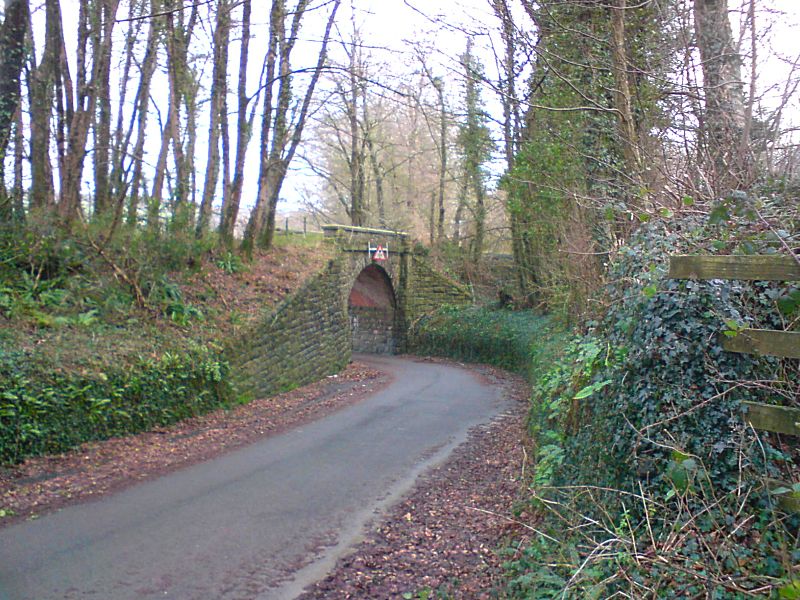
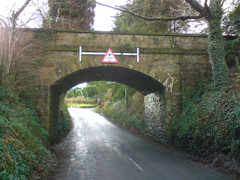
The L&CR bridge near Woodhill Manor just to the north of Liskeard,
after the line leaves High Wood on its
way round from Moorswater,
is probably the best condition bridge that is still extant on the
old line, and
it remains in full use as a bridge, at least in so
far as being a monument to the railway over the road!
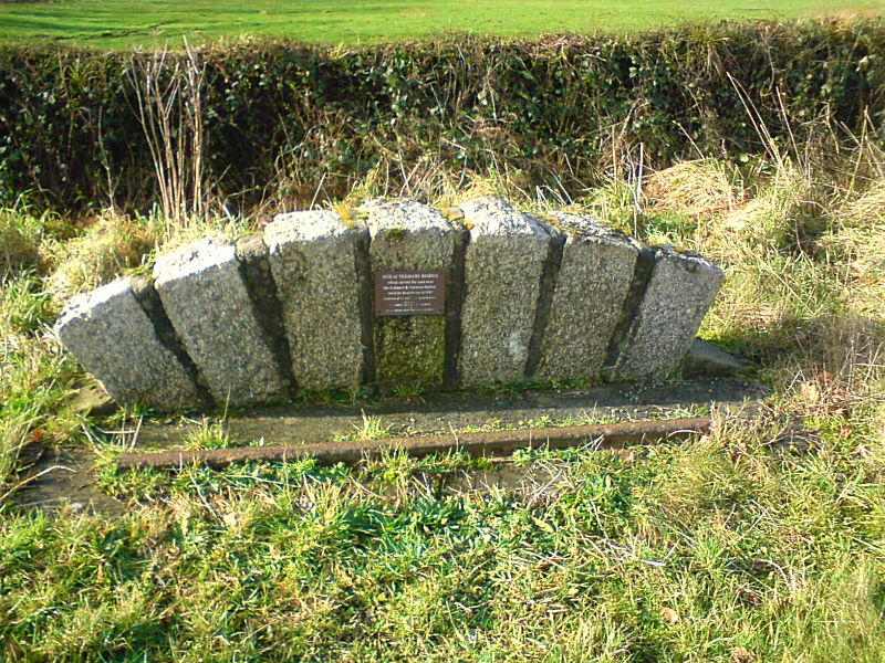
Virtually all that remains of laid track today is the memorial to
the Tremabe Bridge, where the
railway passed under the road just
south of St.Cleer. The bridge was demolished in 1985.
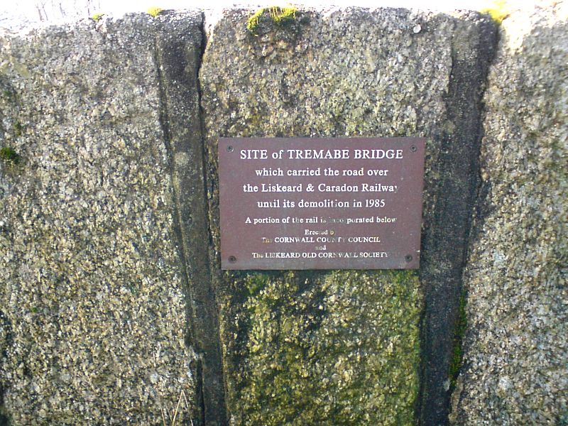
A close-up of the sign on the Tremabe Bridge memorial.
The Liskeard & Caradon Railway bridge in Tremar (near St.Cleer) now
has trees growing on it!
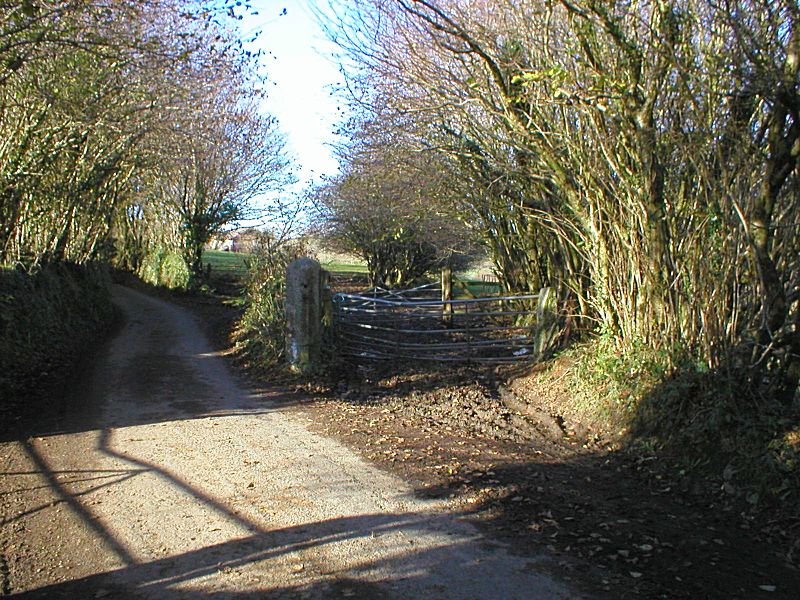
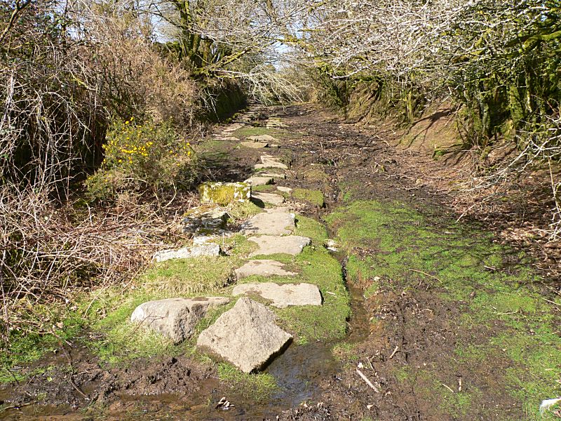
The old crossing along Tremar Lane just to the east of St Cleer,
looking towards the St Cleer goods depot.
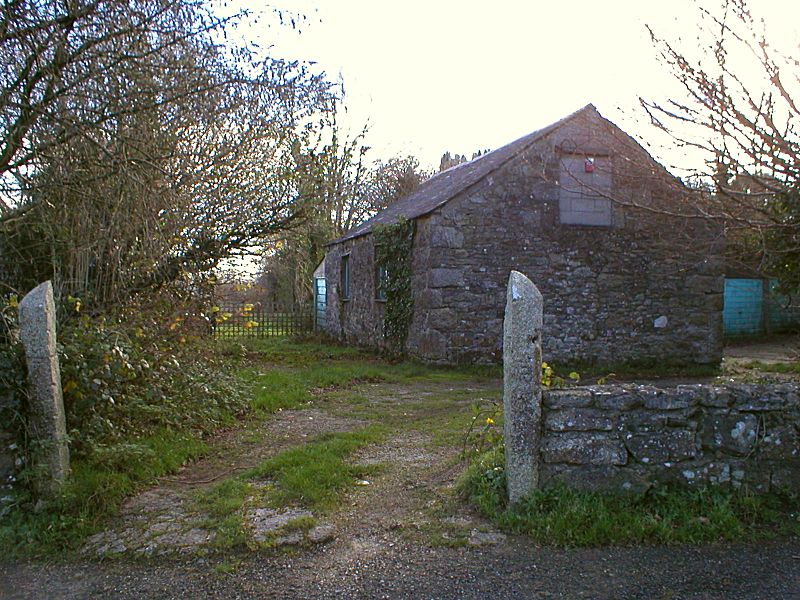
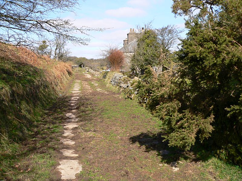
Looking back down the track route of the old line from the road
opposite the Memorial Hall in St Cleer. The
building is the old
goods depot and coal shed, and the gate posts were originally one,
now split in two for their new
purpose - you can just make out
the "plug and feather" drill marks on the left hand one where this
was achieved.
The Gonamena Incline
The line up to Minions originally took the steep route up the Gonamena Incline, which is the missing fourth side of the square around Caradon Hill on the north section map on the following page. This route was operated from its conception, by Act of Parliament, as a gravity-fed line with braked wagons to bring the ore down from the moor, with the empty wagons being horse-drawn back up again. Thus the steep Gonamena Incline was not a specific problem - except perhaps for the risk of runaway wagons! In 1860 through 1887, various improvements to the line were begun, including extensions to Tokenbury and East Caradon, and links to Cheeswring (Minions) and to the Kilmar Railway, then a part of the Chesewring Quarry operations. The use of steam locomotives was then permitted in the following years, though the letter of the law with regards their first use on the line appears to be a little vague! The first locomotive in use was named "Caradon". The lines around Tokenbury and East Caradon to Minions also meant that the steep Gonamena Incline could be bypassed and avoided. This was finally achieved by a "Y" Junction at South Caradon, where trains stopped and were hauled in the opposite direction to continue on to Tokenbury. The Gonamena Incline then fell into disuse.
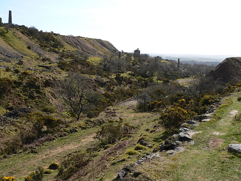
The view looking out over part of the West Caradon and South Caradon
Mines, where the Gonamena Incline
emerges at the top of the
valley. Various trackways and tramways were in use at the bottom of
the incline
and the route can get a little confused on the ground
here.
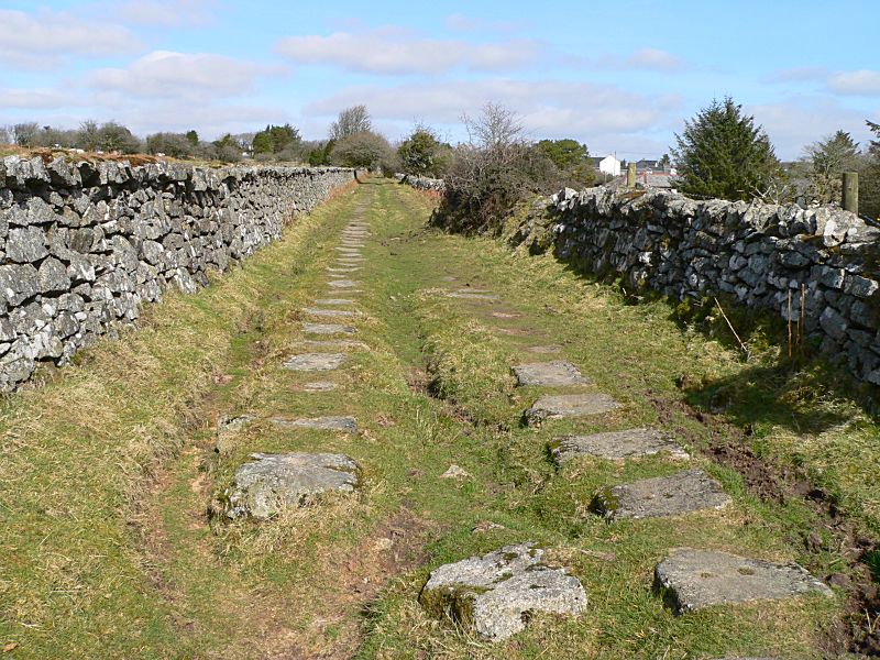
Looking up the remains of a lower section of the incline. The track
stone sleepers can be clearly identified.
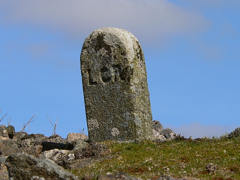
An old stone railway marker, clearly marked "LCR" - Liskeard &
Caradon Railway.
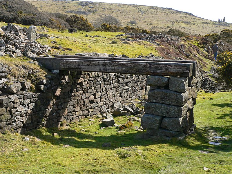
A wooden loading structure of some form perhaps? The railway marker
is seen on top just to the left.
The incline as it heads towards Minions (then Cheesewring Village)
past the lovely old house at Pontious Piece.
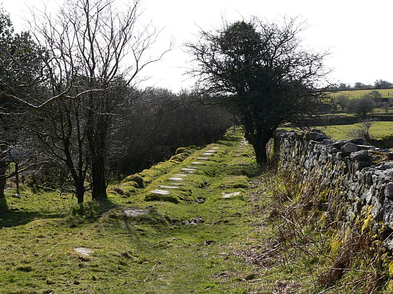
A little more level here, with sleeper stones well preserved, as the
line approaches Minions
Looking down the incline from just outside Minions
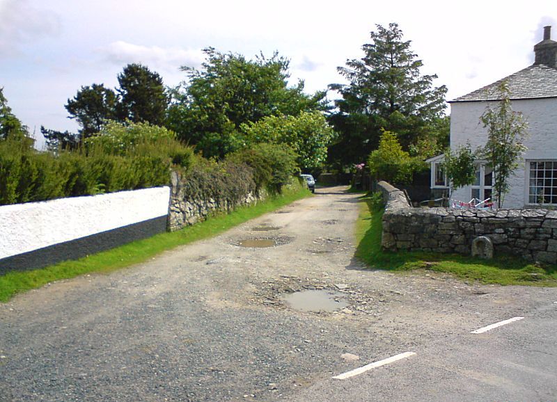
The Gonamena Incline as it emerges into Minions village - a busy
location for a railway!
The line continues along the Caradon to Kilmar section of the line...
Connect with us, Like us and Follow us on Facebook!
PhotoFile Cornwall supports CoaST and Sustainable Tourism